First, a big decision. The eyelets on my existing boots were made of fabric - one had snapped and another was fraying badly. I concluded that I couldn’t risk that one going as well, and reluctantly decided to wear my old leather boots which were in the supply box as backup. I was lucky this had happened when Martin was with me.
I set out from Brora Harbour at 10:30, a little anxious as the boots felt a bit stiff. Within 15 minutes, they had warmed and softened up, like old faithful slippers- no problem there then!
Walking along the lower raised beach, the sea was flat calm and the birds were quiet. I spoke to an elderly gentleman who was walking back to his family in Brora. An electrical engineer by training, he’d gone into the police force and become a chief inspector. He loved it here - “you can hear yourself think” was his comment.
I continued on to find another gentleman resting with his elderly dog on a bench. Asking me where I was headed, he urged me to go to the brilliant River Cafe at Berriedale, and nearly fell off the bench when I told him where I’d come from! I can’t quite resist teasing people now when they’ve asked me how far I’ve walked (“Lands End, 1200 miles”) and they do a double-take!
The path climbed up onto the low cliff tops and from here, I spotted goosander and female eider in the picturesque bay below with ringed plover and oystercatcher on the shoreline.

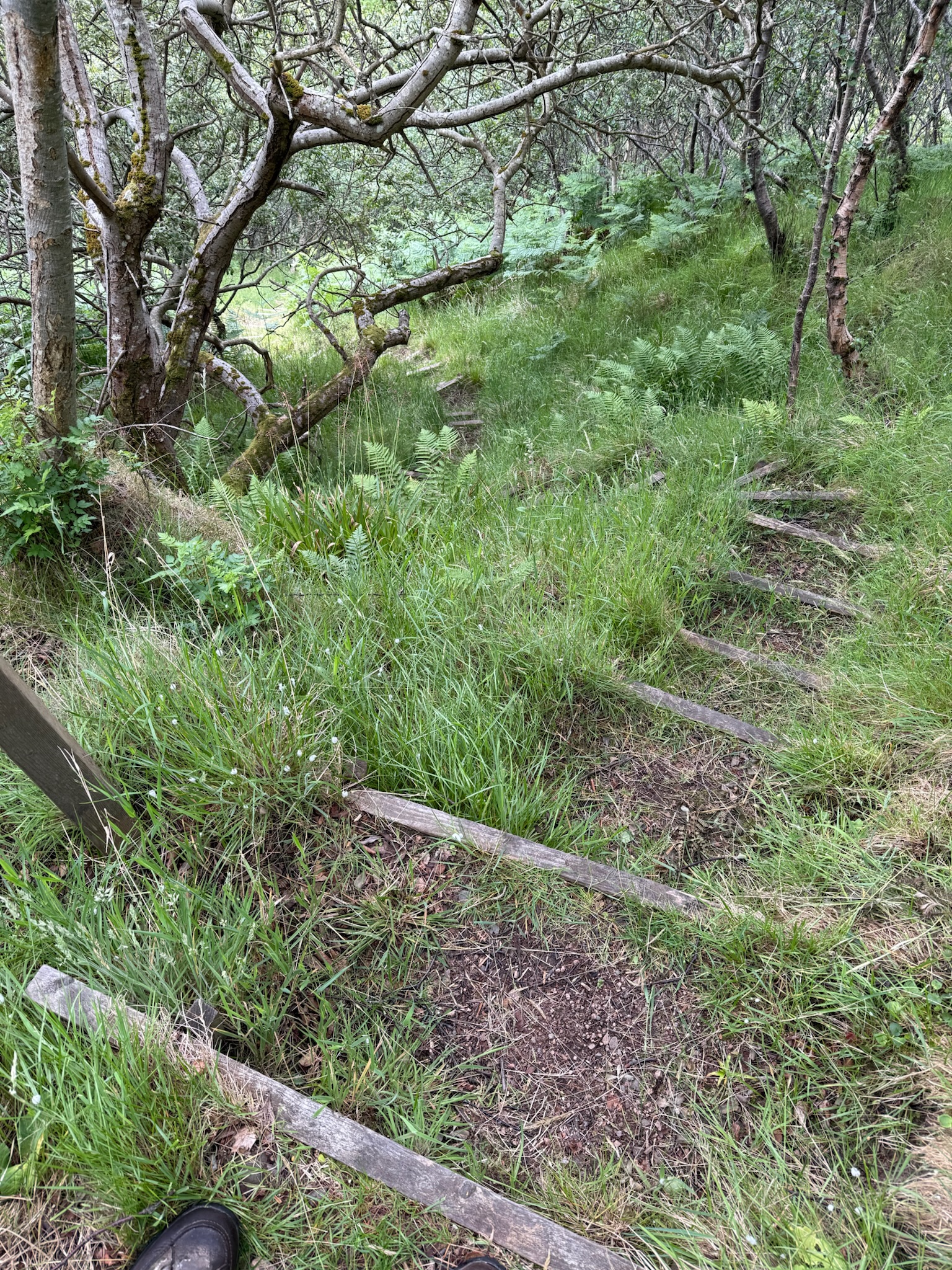
Heading inland a little the path crossed a number of burns, two of them in deep gullies. This was going to be an energetic day involving 510 metres of ascent, but what really set it apart were the very steep slopes, requiring particular effort where there was no distinct path.
After climbing out of Ord Burn, the path travelled through gorse, but it was clear that the vegetation had been recently cut, making it much easier to follow the correct route - I’d just followed a faint path upslope before realising I’d overshot the correct route. This was my mistake. Along this whole stretch it was well signposted provided you paid attention!

I took a short stop above the promontory called Green Table - where apparently, there may have been an old fort - now used by nesting fulmars. I heard the mournful cry of a seal as I was getting up to move on.
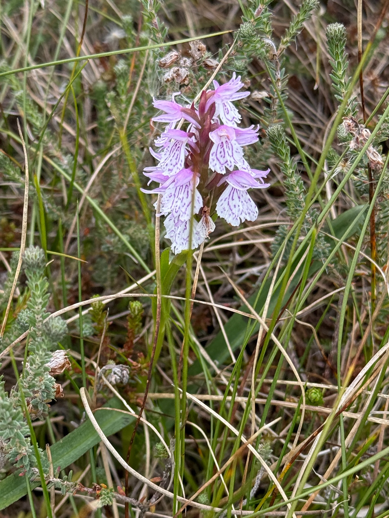
The path was now following the route of the old road before Thomas Telford proposed a more practical route further north which the current A9 still follows to this day. Walking among the heather I thought of Mum for she loved the moors. I’ve not had much success at growing heather in my garden but vowed I’d have another go. The cross leaved heather with its grey green leaves was in flower as was the bell heather with its strong pink flowers. I was chuffed to find a couple of ripe bilberries too - very tasty. I was confused to see something looking like heather which also had black berries - I found out later that these are crowberries - also edible if a little tart when eaten raw.

A stonechat signalled the next signpost to me as I approached another shallow burn. A marshy stretch heading down slope had me using my bog-trotting skills picked up from my father, as I crossed the Ord of Caithness, and the boundary between Sutherland and Caithness.

I stopped for lunch on the Ord, where a gravel path descends from a car park on the A9 to a number of information boards. I learned more about the illustrious Thomas Telford and Abercrombie as engineers, but also Hugh Miller as a geologist who first named the old red sandstone in the 19th century.
The path dropped down past the sorrowful ruins of Borg, a village which fell foul of the highland clearances, before further descending to a beautiful ancient broch.

A steep descent followed - initially a ladder giving warning to just how steep it would be - and a young slow worm and then lizard raced away from my heavy feet. Reaching the bottom of this immense valley I crossed Ousdale Burn to start the steep climb back up the valley to look down on a colony of fulmars with their cackling purrs.
As I reached the bend to see along the coast north, I paused to look back as I could have sworn I heard guillemots. And that’s because there were - lots in the water and I presume in the cliffs out of sight below me. I love guillemots so thrilled to see them again and in such numbers. I lingered for a while taking in all the activity.
As I continued a whitethroat flitted in the bracken ahead of me and I saw lots more guillemots on the water below. Finally a break in the cliffs allowed me to see a stunning view of the guillemot colony below along with yet more fulmars. A superb sight.

My attention was arrested and drawn away from the birds by a number of ruins - the deserted village of Badbea. Once the home for more than a dozen families, by the turn of the 19th century the harsh way of life had taken its toll and the last inhabitant left in 1901. I picked up a real sense of melancholy for a lost village and way of life and arrived at the monument to the village commissioned by the son of one of the inhabitants who had emigrated to New Zealand.

Further marshy land led to a field of lively brown heifers who fortunately decided to run away rather than towards me though gradually following me curiously up the slope while I followed the base of an old stone wall. A tall stile led me to a pleasant track rising gradually and curving around the heather slopes of Cnoc na Croiche, where a number of painted lady butterflies flew.
I chose to go to the top of the hill for a fabulous view into the mountains to the west, before descending back to the track to pick some more bilberries as I went.

Two towers, known as the Duke’s candlesticks, came into view - navigation beacons from the early 19th century facilitating correct alignment for boats entering Berriedale harbour. A ridge down to the left of the lower beacon provided a fun way down but also a great view down onto the harbour. I could see another colony of fulmars and knew Martin would love the harbour so was excited to go down and explore.

As I got down to the A9 shortly after 17:00, it started to rain, but walking back towards the coast I left the rain behind for a while and explored the small harbour, the rickety suspension footbridge and the colony of fulmars on the cliff. And this was where I made an important discovery. I have wanted to identify kittiwakes for a long time, and yesterday had been a revelation seeing them at Brora Harbour. I now had the opportunity to look at the fulmars more closely and realise that in reality most of the birds here were kittiwakes. I felt rather foolish. Seeing them together, I was able to differentiate their calls as well as their flight and detailed appearance. Seen this way it was very obvious how to tell them apart and so I realised I had been seeing kittiwakes before but assumed from a distance I was looking at a fulmar colony, when they were quite likely a mixture. This had certainly been the case earlier in the day.

I have learnt so much during this walk. What a great opportunity and one I hope I have embraced to the full.
Martin picked me up at around 17:45 and couldn’t resist coming to see the harbour as well. We both looked forward to the following day - Martin was going to stop working from now on, and join me on the walk as far as possible.


https://lejog2025ack.blogspot.com/2025/06/the-home-stretch hi the page does not exist, good luck for the last few days! Phil
ReplyDeleteTry this Phil. https://lejog2025ack.blogspot.com/2025/06/the-home-stretch-looking-back-on-my.html?m=1
ReplyDeletethanks! do I calculate just a few days now, blogs usually a day or so behind the walking boots!
DeleteYes - I finish on Monday!
DeleteWhat an amazing lady - you write beautifully. And so much knowledge about birds! My mother was diagnosed yesterday with Alzheimer’s and I want to thank you sincerely for all you are doing to raise awareness. Enjoy the rest of your time in a wonderful setting 😊
ReplyDeleteThank you. And my very best wishes to you and your mother.
DeleteHad no idea how beautiful and interesting the east coast is - and no talk of midges. Enjoy the last {careful!) miles.
ReplyDeleteMuch love Dad xx
It is amazing. So glad I decided to walk this way!
Delete