The previous night we had been delighted when a pine marten came to visit the bird feeders while we ate dinner. The feeders were also drawing in chaffinches, coal and great tits, and siskins. Having decided to delay my rest day to the following day when bad weather was forecast, I still pleaded for a slower start that morning, which meant that with a 90 minute drive back to my start point we didn’t set off until 11am.
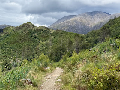
It was a steady and in some places, steep climb out of Kinlochleven, but with a breeze blowing, no midges and plenty of interesting geology to work out. In these lower stretches there was metamorphosed limestone which almost looked like marble in some cases. Further up we saw slate bedding which had been skimmed off by glacial erosion…. Martin acted as model for my photo.
We got to the first col at 12 with fine views back to the north face of some of the Glen Coe crags up the Kinlochleven valley, and into the High Pass where I would continue to walk. Granite was now the predominant rock, so that rather than grey and white, the path was now largely made of red stone. This was where Martin turned back to go and do some work.
I reached the second col at 12:40, looking onto the first of two ruined crofts: Tigh-na-Sleubhaich. I loved the wildness and isolation of the High Pass where the two ruined crofts gave a sense of how life would have been lived in years past, caring for livestock in the summer pastures and supporting the drovers as they moved their livestock to the markets in the Scottish Lowlands. Such a mixed history with the path following the Military Road which I understood was built following the Jacobite risings in the 17th century, which also led to the fort being established at what is now known as Fort William.
Rain came through over the time I would have paused for lunch so I ate on the hoof hoping for a short rest later on. A squall tempted me to shelter from wind gusts at the second of the ruined crofts: Lairig Mor, but I resisted and finally paused just before the dramatic right angled bend of the deep valley. The ever-changing views as the clouds swept across the valley and clung to the peaks meant I had to stir myself to move on.
The next stretch was much longer than I’d allowed myself to think, but once I recovered from that and mentally adjusted the distance still to cover, I settled back into my LEJOG lope - so much easier without the heavier backpack - I continued to enjoy the evolving views, including the fertile limestone slopes on the opposite side of the valley, and then the lake - Lochan Lunn da Bhra - where King Macbeth supposedly lived on one of the islands for awhile. I have to say they looked tiny so this seemed unlikely to me!
It was at this point the path left the old Military Road and followed a regularly undulating route towards the Nevis Forest. Much of the woodland had been cleared so the vista remained open. Rising up to a moorland ridge, suddenly Ben Nevis came into view and the path seemed ever drawn towards its imposing presence. It may not be the most beautiful of mountains - in fact it’s quite a hulk - but its sheer size is undoubtedly impressive and that sense was enhanced by the fact that the path takes you closer and closer before finally drawing away towards Fort William. To arrive at that final, rather tedious forest track, the path first had to cross a deep valley - I caught up with some walkers who were supporting a woman who had twisted her ankle the previous day and was making tortuously slow progress. I felt incredibly sorry for her - even more so as I progressed and realised just how much further they had to go.
I messaged Martin to let him now I was in striking distance of our meeting point - he had driven up theGlen to admire the mountain himself, and fortuously, we arrived at the entry to the car park at the same time.
I had chosen the Braveheart Car Park as this left open the option on the following day’s walk to either ascend the Cow Hill circuit and then drop down into Fort William that way or follow the Glen Nevis Road. That was something I would work out on my rest day, the next day. What a relief!


So pleased that now you have some flexibility in your timing and have Martin to back you up. Also that you are taking a more easterly route after Fort William - fewer midges?!
ReplyDeleteMuch love Dad xx
The wind is successfully keeping the midges at bay, and the anti-histamine has stopped the bites causing me any problems so far!
DeleteAnne xxx