I woke at 6:40 so got up and prepared breakfast and got ready. I left at 8:10am.
There was a steep climb out of the village and then a more gradual track joined Agricola’s Roman Road and open country which I reached at 8:30. This brought me to Siller Holes, where Mary of Guise, Regent of Scotland from 1554 to1560, and mother of Mary Queen of Scots, was reputed to have paid her army with silver from here.

There were gorgeous views back to the Southern Uplands over the meanders of Lyne Water as I passed below Faw Mount. Three mistle thrush landed on fence posts and flew off abruptly when they saw me and then linnets. There were lots of small brown butterflies with orange upper wings - I’d have to check later. The grassy path was magnificent with wide open views - just my sort of country and excellent gradient gaining height steadily.

A path diversion to take it away from the Baddingsgill House. A hare came running out from the stone wall before me, took a good look at me and ran back again. The path dropped down to the stream, and a pair of dippers and a fledgling flew out from the overhanging bank as I approached.
I walked through the Baddingsgill Farm complex which had a thriving timber business, and followed the “thieves’ road” up towards the moorland. A cuckoo called from the woods above the reservoir - I would imagine that could be the last one I hear this year as they migrate south again, having done the deed of laying their eggs with foster parents and escaped parental duty.

I stopped at 11 to top up my calorie intake - the pot porridge and protein snack for breakfast was apparently not quite enough! There were lots of darker brown and pale grey small butterflies fluttering through the heather around me - again I would have to check what they were later.
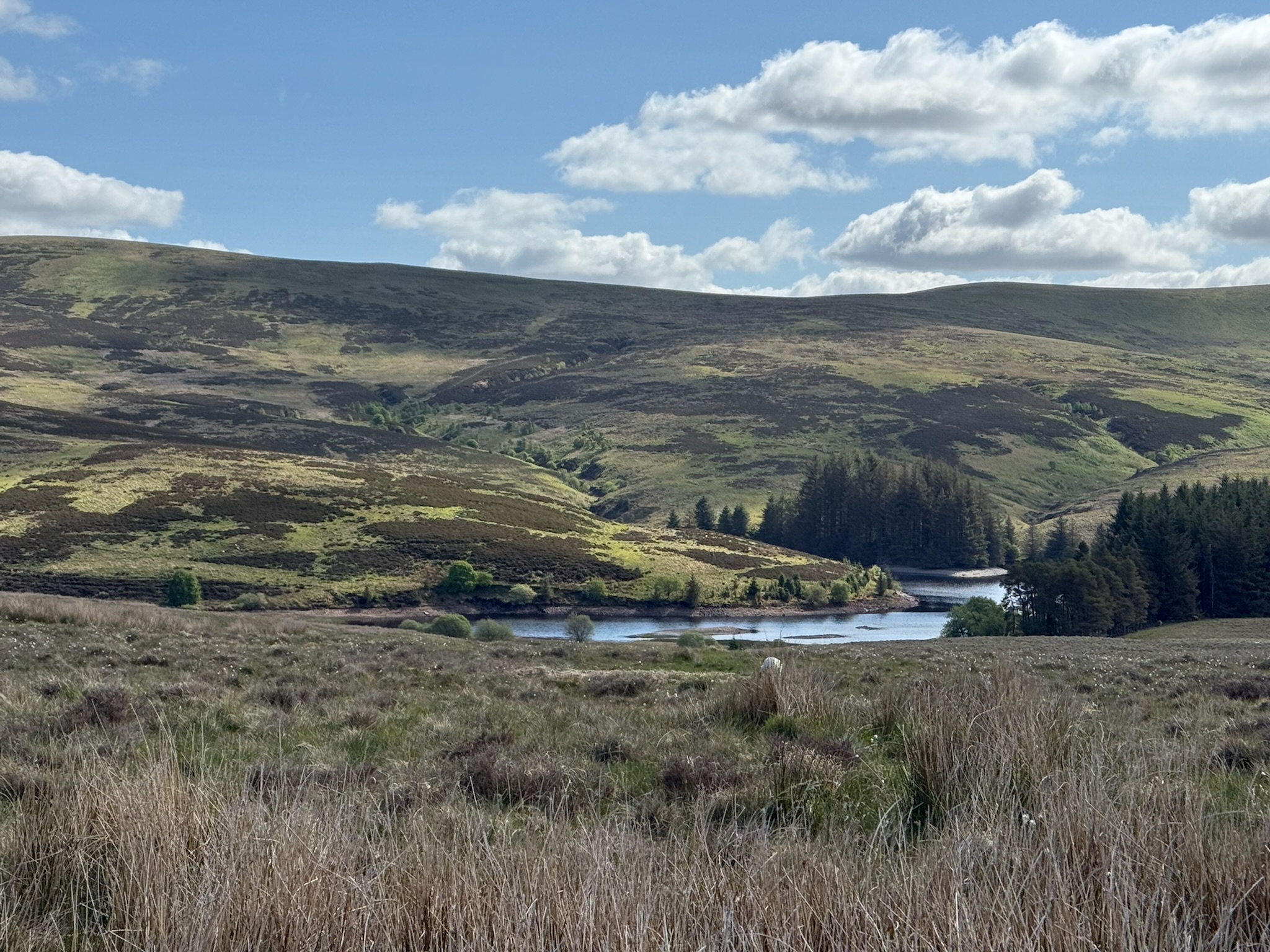
I arrived at Cauldstane Slap at 11:20 with a dramatic change of scene in front of me - from moorland to the the Scottish lowlands and, in the distance, the highlands and an easyJet plane landing at Edinburgh. The visibility was incredible. Coming down to the pasture past Harperrig reservoir, I was delighted to see 3 lapwings fly in among the sheep. I hadn’t seen any for quite awhile - since the Pennine Way.

As I weaved my way through what would normally be wetland, the ground began to rise and I got my very first glimpse of the sea since the Bristol Channel (unless you count the glimpse from across Fell through the mist!) the Firth of Forth leading to the North Sea. It felt a significant moment.
The trail takes you up Corston Hill - what I hadn’t realised was that this would be pathless. Not a problem as such, but I felt uneasy with ground nesting birds so went carefully, but was distracted by two curlew clearly trying to distract me, circling and calling. I nearly trod on their nest but the white of the broken eggshell with a small chick by it caught my eye. There were 3 chicks in close proximity and all well camouflaged. From then on, I ignored the adult birds and kept my eyes glued for any other fledglings or nests.

I stopped at Corston Hill at 13:15 for lunch with a vast panorama before me. With such excellent visibility, I could see the Firth of Forth, Edinburgh and far into the distance the Highlands. Reluctantly I descended the hill heading now for the Scottish Central Belt. I was pleasantly surprised by Calderwood - deep ravines on either side, this was an oasis of woodland.

I had my first encounter with a very broad Scottish accent. The elderly man clearly thought I was bonkers. I stooped to say hello to his elderly sheepdog, when he said something which I didn’t understand - on the third attempt he pointed to his arm and said “whet col’r” at which point I realised he was referring to how brown my face and arms were and I explained I’d walked from Penzance. That took a bit of explaining - by which point he definitely thought I was mad. Then he said words to the effect of that I couldn’t camp here there’d be trouble. Not quite understanding if he meant for my own security or because you’re not allowed I asked about the security of the canal around Roxburn - "oh well that’s no problem it’s lovely." Or at least I think that’s what he said. Which left me completely flummoxed! He walked off, shaking his head muttering “Penzance Penzance …..”
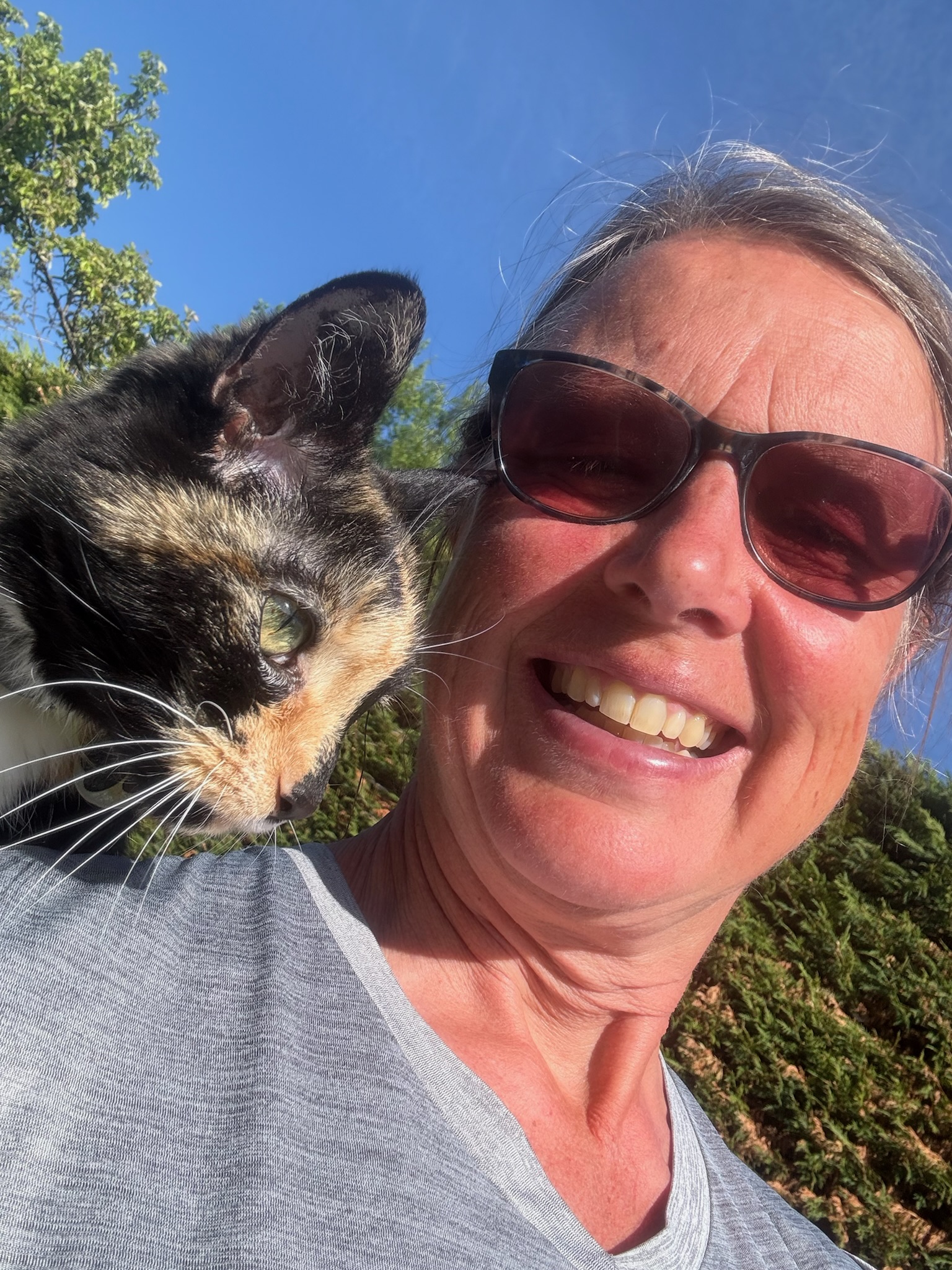
At 15:50 I arrived at Mid Calder and texted Abi for pickup. Staying with Abi, David, little Martha, and Pudding the very affectionate cat would be a treat, and I felt very indulged!


Comments
Post a Comment
Please do leave a comment