Nearly 2/3rds of the way!
I left the accommodation at 7:15 to go to Starbucks for breakfast and lunch supplies. I left there at 8:10.
According to the BGS app I would be walking over Silirian sedimentary rock “Wacke” - sandstone, siltstone, mudstone (443-433 million years ago). I needed to check the geology more going forward.
The path took me through the Galashiels park - a pleasant and gently inclining path which I enjoyed as it gradually joined fields of sheep and then climbed up to Hog Hill 301m which I reached at 9:10.
I reflected on the goodwill of the trails and the people I have met. This was partly prompted by the manner in which Galashiels women my age had walked past me without acknowledgment even after greeting them. Only on the really busy trails would you get this - although this is normal in any town it was notable how accustomed I had got to the friendliness of the trails.
Coming down from Hogs Hill to Yair I heard a classic owl hoot as I entered the woodland descending to Yair - a tawny owl but quite unusual during the day I think.
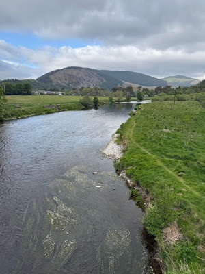
I reached the bridge over the Tweed at 10. Walking along the river - albeit briefly - was again a joy, with herons along the way and a female goosander with her ginger crested head.
The path then climbed steadily through quite dense forest plantation but the views started to open up and by 11:00, I came out of the forest just below the Three Brethren and stopped for elevenses on a stile overlooking the moorland.
Continuing on up a steep incline, after seeing the emerging leaves of geranium all that time ago in the Mendips, I finally saw geraniums coming into flower. I looked across and realised that the Eildon Hills were coming into view - they have stood out ever since coming down off the Cheviots 5 days ago.
I arrived at the Three Brethren at 11:40 with the signpost telling me I was 6.25 miles from Galashiels and 7.5 from Traquair. Almost halfway. It was here that the path joined the Cross-Borders Drove Road for a while.
I had a great chat with a couple doing the SUP with the overall aim of doing all the National Trials over time - like me, they had done the Pennine Way and South West Coastal Path, and were doing the Pembrokeshire CP next year. We laughed as he was taxi-ing back and forth having picked up a leg injury but - like Martin - could end up walking further than her today as he was going to walk out to the Three Brethren from Traquir!
A beautiful grassy path led me towards the highest point of the day at Brown Knowe (526m). A large bird of prey with splayed wings hovered and glided in front of me with barely any wing moment - a female hen harrier.
The wind was certainly lively on the tops - and looking across to some wind turbines it was clear they had been switched off.
Ascending through Heather and some stunning cotton grass I reached Brown Knowe at 13:15, and the man passed me shortly after back to his car, promising that they will follow my blog as I head to JOG. I was delighted to see they had made a donation later that day. I took my time over lunch knowing I now had plenty of time to get down to Traquair and the accommodation at Innerleithen. The views of the rolling hills all around I loved and a dry stone wall provided me the perfect shelter from the wind so that I could enjoy the warmth of the sun.
A couple of cyclists and then rally bikes appeared as I relaxed, reminding me that we were on the Drove Road although it must have been rough going at times for them. I set off again 13:55 leaving the rally bikes trying to fix one which wouldn’t start but they had their toolkit with them and seemed to enjoy the challenge.
Shortly after I noticed a marked trench and checking on the map saw that it was marked as the ancient “Wallace”s trench”.
Having lost a bit of height the Drove Road then ascended towards Minch Moor where it was clear that the trees on the edge of the forest had taken a hammering from one of the storms again. But the devastation of the forest seemed to encourage the birds - suddenly there were lots of siskin and then willow warblers - the forest below had been notably quiet….. and shortly after I saw a pair of buzzards.
I left the South Uplands Way at Traquair and headed for Innerleithen - rather to my relief, although not marked on the OS map or picked up by Google maps there is a track that runs all the way into the town rather than having to walk along the road - and went through mixed deciduous woodland and marshland. Still it seemed like a long trek to walk back to the SUP the following morning.
I arrived at Traquair Arms Hotel at 17:00 having passed tomorrow’s optional route along a disused railway. The noticeboard told me that it largely followed the River Teeed - the other option was to go back to Taquair and go up through Catrona Forest which was all Forestry Commission plantation. I decided I would rather the river route…


Every time I blink you seem to have made a massive progress … I guess it does not feel that way
ReplyDelete