
Day 5: Hayle to Porthtowan (16.5 miles)

Today (Day 5) I started from Hayle Estuary, walking along rippled sand looking like turtle backs in places below cliffs before coming to sand dunes at back where sand levelled out but still soft and a bit difficult to walk on until closer to Gwithian.


Striking mud cliffs then came into view with old sand dunes on top - it was here last time that I scrambled down (with some difficulty) to get onto the beach having found sand dunes hard work! Looking at them today that was a risky scramble - they are quite high. Then a surprise - glorious high cliffs with great folding and stacks close in.

Spotting a shepherds hut we stopped for coffee and bread and butter pudding (with chocolate!!!) sheltering in front of a sand dune. I then continued on to Godrevy Point where I spotted shags nesting in the cliffs before admiring the seals hailed up at Mutton Cove.

The next section is pretty easy going with a long stretch surfaced. I stopped for lunch in a small grassy dell overlooking hell’s mouth, admiring the gulls, with clouds of jackdaws drifting across now and then, hearing a loud crank I was then joined by a gorgeous raven who proceeded to share my lunch. Not interested in mango but loved the cheddars!


A couple of steeper valleys - notably Carvannal with a beautiful waterfall - led me to the cliffs above Portreath where Martin had just arrived. A steep grassy slope down into a small valley /harbour before them coming to Portreath oneself where I had hot chocolate before leaving Martin once again who’s leg was bothering him again, to get myself back on schedule at Porthowan.

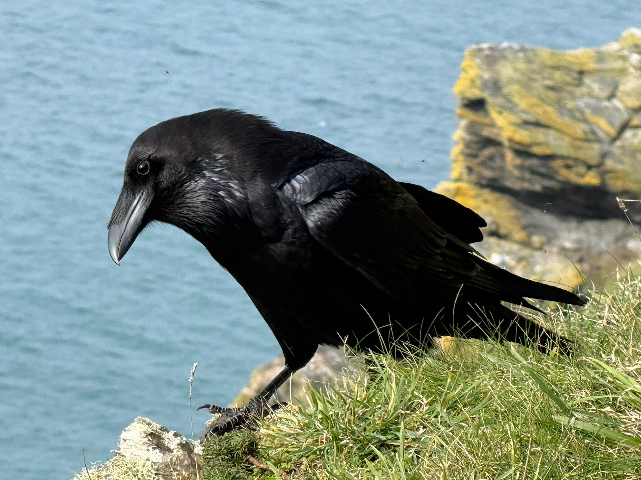
Steep climb up the road and then round the less than attractive Nancekuke disused airfield and a steep valley and I was feeling buoyed by the hot chocolate keeping a good pace as I entered area of dramatic coloured cliffs and the deep Sally’s Bottom as the sun started to drop down and colour.  Overlooking Porthtowan I looked for Martin on the beach and dropping down went the wrong side to him. Seeing him look for me I decided to cross the shallow river, discovering that my right boot was indeed not fully waterproof now. We then went down onto the beach to watch the sun starting to set with dramatic waves and surfers.

And finally a beautiful orange red sunset over Gwithian as we drove back to St Ives completed an excellent day.


Comments

Popular posts from this blog

Choosing the Route

  Since I was first diagnosed with CLL, and started long distance walking, I've been fortunate enough to walk the North and South Downs Ways (2018), the Norfolk Coastal Path (2019), Coast to Coast (2021), the Menorcan Coastal Path and the Ridgeway (2023), the Pembrokeshire Coastal Path, the Dales Highway and the Cotswold Way (2024). In amongst those, I walked the Pennine Way (2020) and the South West Coastal Path (2022) for charity.   In walking these routes, I realised that I love walking on my own, enjoy being immersed in the surroundings around me, able to go at my own pace, stop, observe, and simply be. I love the high moors and mountains but also our beautiful rugged coast - especially the north Cornwall coastline. I very much wanted to re-walk that part of the South West Coastal Path but extended to Penzance - a stretch with which I had been particularly taken.  I also wanted to re-walk the Pennine Way - eventually postponing this so as to incorporate it into t...

Ready, Steady, GO!

On Saturday 15th March I started my big adventure! 2 days in and I have completed the first 32 miles from Penzance to Botallack. I had planned to walk 12 miles each day but my phone says I've done more like 16. The weather has been fantastic but I am very tired. Clearly I am still building my fitness up after the op but I  a sure I will get there step-by-step! The scenery is everything and more than I remembered. This part of the South West Coastal Path is so beautiful but it is certainly tough walking. Tomorrow is planned to be a difficult stretch from Botallack to St Ives but Martin will come and see how I am doing at Zennor and we will go from there. I'm going to have a break from the backpack tomorrow to help me along as it felt very heavy today.

Planning

Whilst I've been recovering from the op, I've had plenty of time to plan my walk.  I had originally intended to simply stop when tired, camping most of the way and booking a bed and breakfast once a week or so. My nerve has deserted me!  I have now broken the walk down into roughly 12 mile days, and I've booked campsites, bed and breakfasts, and ear-marked possible wild camping spots. For much of the time, this tent (Durston Xmid Pro 2P) which I trialled on the Dales Highway in July, will be my home: I have to say, getting stuck into the planning has made me more and more excited that the walk is possible and will actually happen now, with renewed determination to get myself fit and well for the start of the walk. I'm currently walking about a mile a day - sounds awful considering where I was before the op, but never mind.  The target is to increase that over the next 8 weeks to 12 miles, gradually adding weight to the backpack as I fully heal and gain strength. ...